Nikki Henderson on the essential multihull sailing skills you shouldn’t set off without for smooth catamaran or trimaran cruising
The plan is simple: buy a boat and seek out your best life. You’ve decided you want a multihull, for the space and stability that offers.
Your other key requirements are comfort – a yacht you can live aboard for months – and a multihull that’s bluewater capable so you can explore wild remote places. It has to be safe, of course. And spacious enough for you, your partner, maybe your kids (and perhaps someone to help look after them sometimes), or a few friends and family. After all, adventures are better shared.
Bonus items? If the budget allows – performance, please! A fast boat means less time at sea (critical for keeping the non-sailors happy). Faster means more fun, but also the faster you sail the more flexibility you have for weather routing. So speed equals safety.
If this all sounds familiar, that’s because many Yachting World readers dream of the same thing: a bluewater catamaran, powering through the miles, and the freedom of an endless horizon.
Every year, I work with hundreds of people chasing this dream. And wow, it’s a big project! Most begin with hours upon hours, if not weeks, lost to YouTube and online reviews, comparing boat brands. Once committed, the number of decisions to make and to-do list items explodes.
What modifications or custom options will you want? Do you want gas or all-electric? How many cabins do you need, and what layout suits you best? What sails do you need? Who to make them? Then there’s electronics, spares, tools, toys, logistics… and how to leave behind your land life.
Buried in logistics and yard work, cruisers often fall into a common trap: time and time again they forget the sailing element.
Many new catamaran owners are experienced monohull sailors but new to multihulls. Others charter in the Med a few times a year but have never owned their own boat. Some haven’t sailed in years – kids and work got in the way. Some, incredibly, are total beginners.
Article continues below…

What are the best bluewater multihulls for long term cruising? The one you own, or the one you can afford…

There are many categories in the European Yacht of the Year awards, from the best luxury yachts and performance yachts to the best yachts for families and evet…
So when the boat finally arrives or the jobs list is finished in the yard, most owners are exhausted and over-excited. Their sailing skills are rusty. But, at that point, taking the time to polish up their boat handling is not what they want to do. Understandably, they want to slip lines and go.
The problem is that a lack of skill and confidence can lead to a bumpy first couple of years cruising. The best case scenario – if they’re lucky – is that only the boat gets bruised. I’ve seen many boats listed for sale within two years.
Two things matter most to the success of your bluewater experience:
- The brand and model of catamaran you buy
- Your sailing and cruising skills
Your skill and confidence will make or break your experience – and your crew’s too. Here are the 10 top skills to polish before casting off.
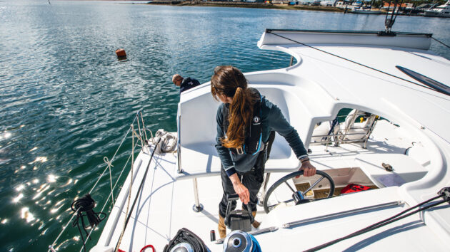
Leaving or manoeuvring in a marina – and dealing with twin engines – is likely to be your first test of handling skills with your new catamaran. Photo: Richard Langdon
Docking a catamaran with Twin Engines
Leaving the marina is going to be the unavoidable first step. The departure sets the tone. Nail it, and there’ll be a good feeling in the air.
Twin engines take some getting used to. First, forget your rudders: lock the helm straight and steer with the engines. Famously, cats can spin on the spot. But it rarely turns out quite as advertised… high topsides, no keel, and light bows mean your ability to pivot is often negated by windage and drift.
Once you figure out how to use the limitations of a cat to your advantage you’ll love the double engines. Practice is key.
Catamaran docking tips
- Stern to wind is your mantra. Keeping the stern facing the wind makes the boat more stable and easier to control.
- Park in reverse. Stay stern to the wind, and you have better visibility and comms with the aft line handler.
- Skip the ‘spin’. Where possible, use a 3/5/7-point turn with one engine at a time. It’s simpler, less confusing and thus less risk-prone. And you can keep the boat to windward of the tight space within your turn.
- Use one hand. Traditionally, driving multihulls was taught with two hands: left hand left throttle; right hand right throttle. Change this to one hand. Then you can move around, twist your torso, see, communicate and park successfully.

Multihulls are becoming increasingly popular for sailors taking on an Atlantic challenge – here setting off on the Atlantic Rally for Cruisers (ARC). Photo: James Mitchell/WCC
Wind angles and routing
Factory polars can be shocking. “50° to windward?! How will I ever get upwind anywhere?” you wonder. Well… yes… catamarans are reaching machines. They don’t point well. Daggerboards help a lot with upwind performance. But even then, crack off 10° and they fly.
Don’t blame your tools. Learn how to use them. So how to best leverage this?
Sail more miles, faster. Cracked off = big speed gains. Sometimes you can still reach a windward destination faster than a monohull of similar length by using this technique.
Wait it out. If a shift is coming in the next few days, consider delaying your departure. Then enjoy a fast few hours of downwind sailing, rather than the 10 hours slog you initially signed up for.
Don’t pinch – it doesn’t work. Accept your angles and see if you can outsmart your own plan. If you do ever see a cat pinching, don’t be fooled. They will be using the engine for assistance.
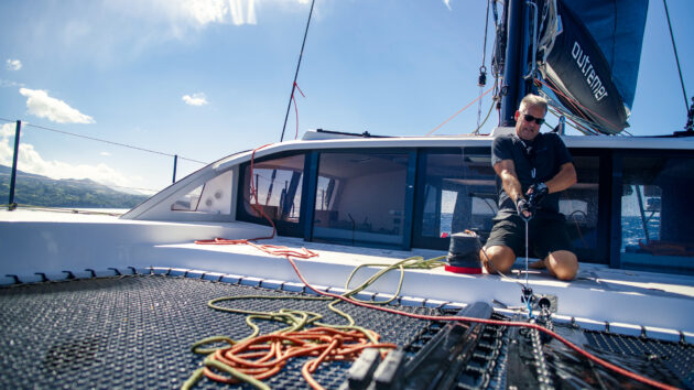
Multihulls are weight sensitive so try to keep heavy items central and low. Leading anchor chain aft away from the bows is prudent. Photo: GLY
Weight management
Cats are wider, roomier, and generally have more space for more stuff (much of which you probably don’t need). But they are also lighter, and more weight sensitive. All this means there is a lot to consider when it comes to stowage.
If you are a monohull sailor, be prepared to pay just as much, if not more attention to how much and where you add extra weight on board.
Catamarans are typically lighter displacement than a monohull of equivalent length, and so extra weight on board will have a greater impact. And, unlike a monohull which relies on its keel for stability, a catamaran relies on its beam. Therefore, loading the catamaran with weight aloft, or not distributing it evenly across both hulls, will make it more prone to heeling and reduce its stability.
What to do
- Live minimally. Be ruthless about what comes aboard. Once ‘stuff’ (the usual culprits are extra kitchen equipment, doubled-up tools and spares, shoes you never wear, water toys you never use) comes aboard, you will feel a sense of ‘loss’ to take it off. Save yourself the grief, and never let it on.
- Keep the ends light. I know they are roomy and no one sleeps there. But they are empty for a reason! Weight needs to be central, and low. Consider storing the outboard motor off the tender and use bow lockers for light gear only.
- Balance port and starboard. One hull shouldn’t carry your whole life. Check from astern on a calm day that your boat isn’t listing.

Reefing early is vitally important with a catamaran. Photo: Marianne Urth
Reefing a multihull
Cats don’t spill any power via heeling. They just power up, until they flip. And that is why reefing is key. Reef proactively. Set strict wind speed reefing thresholds (lots of manufacturers recommend these).
But don’t be afraid to err on the more cautious side, as the guidelines rarely take into account sea state.
Multihull reefing tips
- Topping lift! No vang means the boom drops hard onto the roof without it.
- Mainsails don’t drop easily. There is a lot of friction due to full battens compressing mast cars, and probably a 2:1 halyard. Consider using downhauls on the luff or upgrading mast cars to ones with roller bearings and using the reefing line to coax the sail down. If all else fails, you can change course upwind but be cautious of the increased apparent wind when you do that.
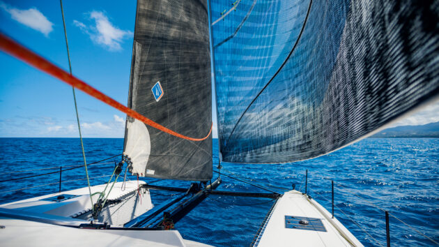
Keeping weight out of the ends is key for sailing performance. Photo: GLY
Depowering a multihull
As aforementioned, gusts don’t spill power on a cat – they load it up. Multihulls can take a lot, but the line between everything being fine and not fine is sudden. You need a fast, simple depowering setup in case of any unexpected gusts or squalls.
The previous advice was to reef early – but we aren’t always good at that. So you need a plan if you get caught out and miss the window of opportunity to reef.
Multihull depowering tips
- Active sheets. Keep these on winches with the clutches open – always the mainsheet and headsail/spinnaker sheet.
- Traveller dump. The windward traveller line should also be ready to dump. In a gust, this can be your first move because it’s in the cockpit where you also are likely to be.
- Bear away. Go for a quick bear away as soon as you’ve depowered the sails to reduce the apparent wind. Practice hand-steering this.
- Turn downwind fast. Quickly straighten the helm the moment you don’t feel the wind on your windward cheek.
- Daggerboards. Keep the leeward daggerboard line on a winch ready to quickly raise it to avoid tripping.
- Depowering. For kites and gennakers, set up quick-release tack systems for instant depowering.
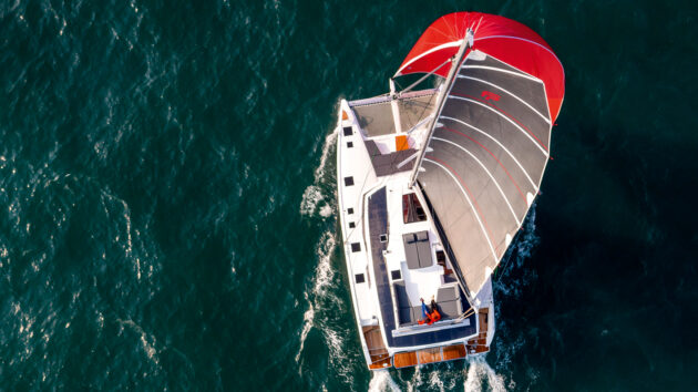
Catamaran sailing is all about the fun –especially downwind, when properly set up. Photo: Jean-Marie Liot
Downwind sails
Cats sail downwind like a dream, so it’s time to embrace that. You’ll be especially thankful for your and your crew’s proficiency with the spinnaker or Code 0 when the winds soften and you have a long ocean passage ahead of you.
Any monohull sailors might underestimate the gains to be made by flying downwind sails. But a few knots can make a big difference over 3,000 miles. Anyway, you are out of excuses! Cats are stable, the bow is safe – and with its big soft nets, it’s even kind to your knees. There’s no justification for not going up there and giving this a go.
Downwind catamaran tips
- Practice the drop. If you know you can get it down, you overcome the fear of putting it up. This might include using socks, furlers, or a traditional drop to douse the offwind sails. Nail them all!
- Optimise your systems. Make hoisting, flying and dropping these intimidating sails easier – reroute lines if needed, add Martin Breakers (a quick-trip shackle to release tack line under load) and use electric winches if that helps smooth
the routine. - Learn the angles. The more you understand about what wind strengths and angles your sails love, the more likely you’ll be to fly them. Get as much data as possible, or a sail crossover chart from your sailmaker. And also keep a good log and note your own numbers.
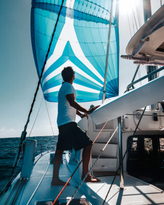
No excuses to go without a kite. Photo: Saskia Stainer-Hutchins
Feedback cues
We’ve all been there. You go off watch with the boat sailing peacefully in 10-15 knots. And you wake up having fallen out of bed, the boat heeled over hard, in 20 knots upwind. You will now reminisce on those days with fondness. As a catamaran sailor, you are going to have to master the art of subtlety. Specifically, interpreting less obvious feedback that the boat is overpowered or underpowered.
Tips for tuning in
- Use the instruments. But don’t use them in isolation. Boat speed and wind speed tell you a lot and it’s critical to respond to them with reefing (see point No4). However, you can also sense a few degrees of heel, a change in acceleration, or a shift in pressure with your body. The less reliant you are on instruments and the more intuitive your relationship is with the boat, the safer you will be.
- Use your hearing! Listen for slamming, rig hum, and the frequency of the wave slap.
- Log what you ‘feel’. Log regularly and include wider information so you can look back and compare. For example, if a few weeks ago you were happily eating dinner with no reefs in the main, what’s different this time? The sea state? Your fatigue? Intuition?
- Power down early. Comfort trumps speed on cruising boats 99% of the time (which can be hard to adapt to for successful, driven people). But remember the dream – it’s usually a version of ‘slowing down’.

Living the bluewater dream, anchored in an idyllic spot – and catamarans can drop the hook in relatively shallow water. Photo: Robin Christol/GLY
Manoeuvres
Two hulls change things when it comes to manoeuvres: tacking is slow, gybing is violent. You need to get comfortable with it all.
It’s not uncommon to find catamaran sailors who avoid manoeuvres at night. That’s great in theory – until you sail into a wind hole, or want to avoid a squall, or need to miss a cargo ship. Really every bluewater sailor needs to know how to complete manoeuvres in all conditions, at any time of day.
Upwind Manoeuvres
Build up speed before the tack and use it to carry you through. Remember, angles are wider and the turn may well be more than 100°.
If you have them, and they aren’t already down, drop both daggerboards to the same level. It gives you some grip during the turn.
Back the jib through the tack if needed (unless it’s self-tacking, in which case get creative with a handybilly or extra control line).
Downwind Manoeuvres
With a square top, big roach and full battened mainsail, gybing can be exciting. The main needs a lot of control through the gybe. Centre the traveller and make sure it’s locked off on both sides, tighten up the mainsheet, gybe – then control the sheet to dampen the slam when it flips to the other tack.
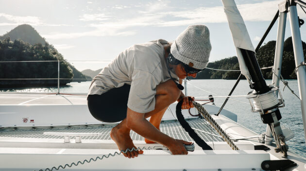
A remote-controlled windlass will be a big help when retrieving and viewing your anchor tackle, while headsets help maintain communication with the helm. Photo: Saskia Stainer-Hutchins
Catamaran anchoring
Most cruisers are at anchor about 80% of the time, even if they are ‘sailing around the world’! It’s a critical skill, and a core element of living the dream.
But in order to spend your days swimming off the back of the boat or enjoying serene sunset cocktails on the bow – and to comfortably sleep, make repairs, and live on the hook – you need to be able to anchor confidently, reliably and securely.

Making sure the hook is properly set will ensure a more relaxing time in that idyllic anchorage. Photo: Kinetic Catamarans
Catamaran anchoring skills
- Set it properly. Use 3-7 times the depth. Reverse hard on it (1,500-2,000rpm) – better to drag and find out it’s not holding now, rather than at 3am.
- Find space. Choose a spot with not too many boats around. If there are, make sure they’re catamarans too as similar hull shapes swing similarly. Resist the temptation to be too close to the beach in the crowds (instead, get a fast tender and learn how to use it).
- Always use a bridle. If it isn’t already set up, attach a mooring line of identical length to each bow cleat and tie both to the chain in the same place with a prussick knot or rolling hitch.
- Float the chain. Learn to float the chain in preparation for the reef-laden anchorages of French Polynesia or other heavenly spots. Use a couple of traditional heavy plastic fenders at about 10m increments.
- Shorelines. Know how to set up a shoreline to control your swing. This will open up the tighter anchorages, or the deeper ones, which can be beautiful. Anchor as normal and then head ashore with a long line and tie it to something stable like a tree or a rock.
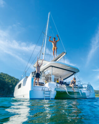
Photo: Lagoon Catamarans
Enjoy the comfort
Sometimes sailors can be a bit masochistic. Let that go. This dream involves two hulls – it’s time to get comfortable.
Before departure, try to relax. You don’t need to prep every meal in advance and psychologically prepare yourself for beyond three or four days of the usual motion sickness. Instead, think about activities to keep everyone busy and entertained.
You can cook, bake, eat, sleep, do yoga, workout, learn the guitar, or dance while underway (yes, I’ve done all of the above). This is a lifestyle.
Just one thing to remember: when sailing downwind the wind funnels through the saloon, so card games don’t work so well. Everything else? Go for it.
I feel so lucky to have spent so much time around people making this dream into their reality. It’s inspiring to see people brave enough to go after more from their life. So if you want to make that dream last you’ll need to invest in the skills to make it work. Docking, reefing, routing, anchoring – mastering these techniques will add a layer of safety, confidence and ease to your experience.
 If you enjoyed this….
Yachting World is the world’s leading magazine for bluewater cruisers and offshore sailors. Every month we have inspirational adventures and practical features to help you realise your sailing dreams.
Build your knowledge with a subscription delivered to your door. See our latest offers and save at least 30% off the cover price.
Note: We may earn a commission when you buy through links on our site, at no extra cost to you. This doesn’t affect our editorial independence.